Showing posts with label sky watch friday. Show all posts

Thursday, November 8, 2012

Sky Watch


This photo was shot in May 2012 on my way home from work. I love cumulus!!

Cumulus clouds are a type of low-level cloud that can have noticeable vertical development and clearly defined edges. Cumulo- means "heap" in Latin.[1] They are often described as "puffy" or "cotton-like" in appearance, and are generally less than 6,500 feet (2,000 m) in altitude, unless they are of the vertical cumulus congestus form. Cumulus clouds may appear alone, in lines, or in clusters. Cumulus clouds are often precursors of other types of clouds, such as cumulonimbus, when influenced by weather factors such as instability, moisture, and temperature gradient. Cumulus clouds are part of the larger category of cumuliform clouds, which include stratocumulus cloudscumulonimbus cloudscirrocumulus clouds, and altocumulus clouds.[2]
From Wikipedia, the free encyclopedia
Happy sky watch Friday
Jessika aka cloudstalker

Friday, July 20, 2012

Sky Watch Friday

I'm Back!!!!!
Happy Sky Watch Friday It has been quite awhile since I joined in on this fun activity. 
This picture is of a small island called Three Ricker Isle. One of my favorite spots to be.

Thursday, October 23, 2008

sky watch #18


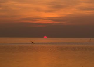
Yup another sunset sky watch, I just cant help myself. We went to Port Richey waterfront park yesterday for dinner -Burgers and chips- And I took 87 pictures while I was there. My hub asks why I take so many pictures and I tell him today will be gone tomorrow but I have it forever at a touch of a button. Make sense? I think so.
Happy sky watching!!!
Jess
Sunset Stalker

Thursday, October 16, 2008

sky watch/Fair-weather clouds


.


Fair Weather Cumulus Clouds
Fair weather cumulus have the appearance of floating cotton and have a lifetime of 5-40 minutes. Known for their flat bases and distinct outlines, fair weather cumulus exhibit only slight vertical growth, with the cloud tops designating the limit of the rising air. Given suitable conditions, however, harmless fair weather cumulus can later develop into towering cumulonimbus clouds associated with powerful thunderstorms.

Fair weather cumulus are fueled by buoyant bubbles of air, or thermals, that rise upward from the earth's surface. As they rise, the water vapor within cools and condenses forming cloud droplets. Young fair weather cumulus have sharply defined edges and bases while the edges of older clouds appear more ragged, an artifact of cloud erosion. Evaporation along the cloud edges cools the surrounding air, making it heavier and producing sinking motion (or subsidence) outside the cloud.

Source


This will be my 17th Sky watch, wow. I look forward to this all week. This weeks pics are from Sunday, my son and I went on a nice long bike ride which ended up in a new park they built out side of our neighborhood. I got a lot of cool shots if you scroll down a little you will see a couple I posted.
I just Love the sky!

Thank you for stopping in Happy sky watching!
Jess
Cloud Stalker

Thursday, October 9, 2008

Sky Watch Friday/What Determines Sky's Colors At Sunrise And Sunset?

Sky Watch Friday is hosted by:Tom, Sandy, IMAC , Klaus & Ivar. For a free trip around the world to see the skies click HERE.


What Determines Sky's Colors At Sunrise And Sunset?
ScienceDaily (Nov. 15, 2007) — The colors of the sunset result from a phenomenon called scattering, says Steven Ackerman, professor of meteorology at UW-Madison. Molecules and small particles in the atmosphere change the direction of light rays, causing them to scatter.


Scattering affects the color of light coming from the sky, but the details are determined by the wavelength of the light and the size of the particle. The short-wavelength blue and violet are scattered by molecules in the air much more than other colors of the spectrum. This is why blue and violet light reaches our eyes from all directions on a clear day. But because we can't see violet very well, the sky appears blue.

Scattering also explains the colors of the sunrise and sunset, Ackerman says.


“Because the sun is low on the horizon, sunlight passes through more air at sunset and sunrise than during the day, when the sun is higher in the sky. More atmosphere means more molecules to scatter the violet and blue light away from your eyes. If the path is long enough, all of the blue and violet light scatters out of your line of sight. The other colors continue on their way to your eyes. This is why sunsets are often yellow, orange, and red.”

And because red has the longest wavelength of any visible light, the sun is red when it’s on the horizon, where its extremely long path through the atmosphere blocks all other colors.

Photobucket - Video and Image Hosting


SOURCE
I hope everyone has a great weekend and have a great time sky watching!!!
Jess
Cloud Stalker

Thursday, October 2, 2008

Sun Halo-Skywatch Friday


Sky Watch Friday is hosted by:Tom, Sandy, IMAC , Klaus & Ivar
For a free trip around the world to see the skies just click on the link.


A halo (ἅλως; also known as a nimbus, icebow or Gloriole) is an optical phenomenon that appears near or around the Sun or Moon, and sometimes near other strong light sources such as street lights. There are many types of optical halos, but they are mostly caused by ice crystals in cold cirrus clouds located high (5–10 km, or 3–6 miles) in the upper troposphere. The particular shape and orientation of the crystals is responsible for the type of halo observed. Light is reflected and refracted by the ice crystals and may split up into colors because of dispersion, similarly to the rainbow.

Sometimes in very cold weather optical halos are formed by crystals close to ground level, called diamond dust. The crystals behave like jewels, refracting and reflecting sunlight between their faces, sending shafts of light in particular directions.

Atmospheric phenomena such as halos were used as an empirical means of weather forecasting before meteorology was developed.

Other common optical phenomena involving water droplets rather than ice crystals include the glory and the rainbow.
SOURCE

This photo was taken in July of '07. I have featured this photo before in this blog, but I thought I would share it with the sky watchers.
I started a new blog yesterday called Silly Me I started it because in these hard times everybody needs a smile. So each day I am posting a joke from all the fwrds I get in my email box.If you have a funny joke or a funny picture you would like to share with me you can send it to my email @ cloudstalker.jess@yahoo.com.
Have a fantastic day!!
Peace and Love!!
Jess
Cloud Stalker

Thursday, September 25, 2008

SKY WATCH FRIDAY/ON THURSDAY


To see the sky from around the world click on this link. Thanks to Tom, Sandy, IMAC & Klaus for making this so much fun! Today's Picture is from last week we had a A stationary front stalled over my area, which created such beautiful skies. If you scroll down to my past post you will see more of the beautiful skies i captured. With each passing moment the skies changed it was fantastic. God's handy work.

A stationary front is a boundary between two different air masses, neither of which is strong enough to replace the other. They tend to remain essentially in the same area for extended periods of time, and waves sometimes propagate along the frontal boundary. A wide variety of weather can be found along a stationary front, but usually clouds, prolonged precipitation, and storm trains are found there. Stationary fronts will either dissipate after several days or devolve into shear lines, but can change into a cold or warm front if conditions aloft change.-source


There was no rain for us here but along the seabreeze boundaries storms were popping up everywhere.

Jess
Cloud Stalker

Friday, September 12, 2008

Skywatch Friday/Hurricane Ike


Photo taken yesterday afternoon.looking to the west. With Hurricane Ike in the gulf of Mexico our skies have been filled with clouds of all types. I like this shot because the tree puts a frame around a confused sky.

This shot was taken from looking strait up.

This shot was taken looking to the north.

This shot was taken looking from the east

Onto Hurricane Ike

I wanted to share this from Dr.Jeff Masters blog you can view it in whole by clicking on his name.
Posted by: JeffMasters, 3:26 PM GMT on September 12, 2008
Hurricane Ike is closing in on Texas, and stands poised to become one of the most damaging hurricanes of all time. Despite Ike's rated Category 2 strength, the hurricane is much larger and more powerful than Category 5 Katrina or Category 5 Rita. The storm surge from Ike could rival Katrina's, inundating a 200-mile stretch of coast from Galveston to Cameron, Louisiana with waters over 15 feet high. This massive storm surge is due to the exceptional size of Ike. According to the latest wind field estimate (Figure 1), the diameter of Ike's tropical storm and hurricane force winds are 550 and 240 miles, respectively. For comparison, Katrina numbers at landfall were 440 and 210 miles, respectively. As I discussed in yesterday's blog entry, a good measure of the storm surge potential is Integrated Kinetic Energy (IKE). Ike continues to grow larger and has intensified slightly since yesterday, and the hurricane's Integrated Kinetic Energy has increased from 134 to 149 Terajoules. This is 30% higher than Katrina's total energy at landfall. All this extra energy has gone into piling up a vast storm surge that will probably be higher than anything in recorded history along the Texas coast. Storm surge heights of 20-25 feet are possible from Galveston northwards to the Louisiana border. The Texas storm surge record is held by Hurricane Carla of 1961. Carla was a Category 4 hurricane with 145 mph winds at landfall, and drove a 10 foot or higher storm surge to a 180-mile stretch of Texas coast. A maximum storm surge of 22 feet was recorded at Port Lavaca, Texas.

This Storm could make history folks. My prayer goes out to all those who will be effect by this huge storm. There talking 50ft waves. Holy Moly! God be with them all!
A fellow blogger is making his journey to Galveston now if you want to check in with hi, go to Ham Wx His live feed should be up soon.
Jess
Cloud Stalker

Friday, August 29, 2008

Skywatch Friday

With all the rain we have had i have seen quite a few rainbows,i still havent found the pot of gold, but i havent stop looking ether.
Skywatch friday to join in with the world click on this LINK


Some where under the rainbow there is always a wacky weather chick with a camera.

Jess
Cloud Stalker

Thursday, July 17, 2008

Sky Watch

Happy Sky Watch Everybody!! A Big Hello from Pasco, Florida I am located on the west coast right in the center of the state. If you want to take a trip around the world come and register a the sky watch blog
This has been a fun weather week for me. It has rained every day in fact we have received just about 8 inches of rain since last Saturday. I took some in between the rain shots This week I hope you enjoy them! Have a great weekend!!!


Jess
Cloud Stalker

Friday, July 11, 2008

Sky Watch

Waves in the sky


Join sky watch by registering at Tom Wigely blog
Have A great weekend to all!!!
Jess Cloud Stalker

Thursday, June 26, 2008

Sky watch/Stormy skies

SKY WATCH
Share your sky shots with the world!! Go to Tom Wiggley's site and register your web address!


Florida summers are awesome!! The skies are always so amazing! These photos were taken yesterday afternoon, I through in the last one for a little color.
Have a great weekend!
Jess
Cloud stalker

Thursday, June 12, 2008

Sky watch Friday


Come and take a tour of the world with Mr. Tom Wigley as your host! Just click on his name to register.


Morning Glory


After the rain


While it was raining


Happy Sky Watch Friday to all!! Have a great weekend!!!
Jess
Cloud Stalker

P.S. The sky is talking ooh ahh love to hear the thunder

Thursday, May 29, 2008

Sky watch Friday


SKY WATCH FRIDAY- Your Host Mr. Tom Wigley register your favorite sky photo an share it with the world!


BLUE SKIES AND PALM TREES BABY!


SHADOW FUN


CAN U SEE MY SHADOW IN THE TREE?


Yes me and my camera having been having fun. I have been taking all kinds of pictures. flowers,ant piles,trees. I liked the shadow pictures the best out all the pictures I took.
The top picture titled "Blue skies and palm trees baby" represents May 2008 in Pasco, Florida.
I took a couple pictures of my shadow alone and i did not like how fat i look. I am such a girl!!LOL. I will however share one with you because I'm not that vain. I warn you though I look like a weeble wobble!


Peace and love to all!!!
Happy Sky watch and have A great weekend!