A low pressure area over Georgia and a weak surface trough extending southwest from the low will slowly settle southward into the northern Gulf Coast region on Friday, fueling the development of scattered to numerous showers and thunderstorms over much of northern Florida. Some storms could be strong. Higher moisture content over the area will allow the likelihood of heavy rainfall to accompany some of these storms. Such heavy rainfall could cause temporary flooding of urban and low-lying locations. Other threats include deadly cloud-to-ground lightning and brief gusty winds.
Over the peninsula and Keys, weak and ragged high pressure overhead will do little to suppress convection Friday afternoon. Light winds and sufficient low level moisture will still allow for Atlantic and Gulf sea breeze boundaries to develop and move inland, triggering isolated thunderstorms during the late afternoon and early evening hours. Expect cloud-to-ground lightning strikes, brief gusty winds and locally heavy rainfall to accompany these storms. In addition, there will be a chance of isolated waterspouts in the Keys. Activity will diminish after sunset, with only a few isolated showers or thunderstorms possible overnight along the coast and nearshore areas of South Florida and the Keys.
The aforementioned trough of low pressure is forecast to stall over northern Florida this weekend, keeping rain chances above average through Sunday. By Labor Day, rain chances should return to the scattered afternoon variety typical of August. Isolated to scattered afternoon showers and thunderstorms will be possible through Monday in the peninsula and Keys. Although no widespread severe weather is expected, a few storms could be strong.
In the tropics, several areas of low pressure are located off the eastern U.S. coast. The most organized of these lows is centered east-southeast of the New Jersey coast. There is some potential for this system to develop further, but it is no threat to Florida since it is forecast to move northeast into the cooler waters of the North Atlantic. The remaining lows off the U.S. east coast are forecast to move away from the U.S. and not develop significantly, if at all.
An area of low pressure associated with a tropical wave is located about 300 miles east-southeast of the Lesser Antilles, or about 1,900 miles southeast of the South Florida coast. This system has become better organized, and it could develop into a tropical depression during the next 24 hours as it continues toward the west at around 15 mph. A reconnaissance aircraft is scheduled to investigate the system Friday afternoon.
In the far eastern Atlantic, an area of low pressure associated with a tropical wave is located about 250 miles west-southwest of the Cape Verde Islands. Drier air currently surrounding this system will hamper any significant development through the next few days.
Atlantic SPECIAL TROPICAL DISTURBANCE STATEMENT
000 WONT41 KNHC 311310 DSAAT SPECIAL TROPICAL DISTURBANCE STATEMENT NWS TPC/NATIONAL HURRICANE CENTER MIAMI FL 910 AM AST FRI AUG 31 2007 SATELLITE IMAGES AND SURFACE OBSERVATIONS INDICATE THAT THE TROPICAL WAVE AND ASSOCIATED LOW PRESSURE AREA LOCATED ABOUT 250 MILES EAST OF THE WINDWARD ISLANDS COULD BE DEVELOPING INTO A TROPICAL DEPRESSION. AN AIR FORCE RESERVE HURRICANE HUNTER WILL INVESTIGATE THE SYSTEM EARLY THIS AFTERNOON TO CONFIRM IF A DEPRESSION HAS FORMED. WATCHES AND WARNINGS MAY BE REQUIRED FOR PORTIONS OF THE WINDWARD ISLANDS...AND ALL INTERESTS IN THAT AREA SHOULD BE READY TO TAKE QUICK ACTION...IF NECESSARY. REGARDLESS OF DEVELOPMENT... HEAVY RAIN AND STRONG GUSTY WINDS WILL SPREAD OVER THE WINDWARD ISLANDS LATER TODAY AND TONIGHT. $$ FORECASTER BLAKE/AVILA
Atlantic Tropical Weather Outlook
000 ABNT20 KNHC 310930 TWOAT TROPICAL WEATHER OUTLOOK NWS TPC/NATIONAL HURRICANE CENTER MIAMI FL 530 AM EDT FRI AUG 31 2007 FOR THE NORTH ATLANTIC...CARIBBEAN SEA AND THE GULF OF MEXICO... A WELL-ORGANIZED AREA OF LOW PRESSURE...ASSOCIATED WITH A TROPICAL WAVE...IS CENTERED ABOUT 300 MILES EAST-SOUTHEAST OF THE WINDWARD ISLANDS AND IS MOVING WESTWARD AT ABOUT 15 MPH. SHOWER AND THUNDERSTORM ACTIVITY HAS INCREASED DURING THE PAST FEW HOURS...AND A TROPICAL DEPRESSION COULD FORM LATER THIS MORNING. REGARDLESS... AS THE SYSTEM PASSES THROUGH THE WINDWARD ISLANDS LATER TODAY AND TONIGHT...IT WILL BE ACCOMPANIED BY SHOWERS AND THUNDERSTORMS...AND WINDS WITH GUSTS TO TROPICAL STORM FORCE. INTERESTS IN THE WINDWARD ISLANDS SHOULD CONTINUE TO MONITOR THE PROGRESS OF THIS SYSTEM. AN AIR FORCE RESERVE HURRICANE HUNTER AIRCRAFT IS SCHEDULED TO INVESTIGATE THE SYSTEM THIS AFTERNOON. A SMALL AREA OF LOW PRESSURE LOCATED ABOUT 200 MILES EAST-SOUTHEAST OF ATLANTIC CITY NEW JERSEY IS MOVING SLOWLY NORTHWARD...AND IS EXPECTED TO TURN NORTHEASTWARD LATER TODAY AHEAD OF AN APPROACHING FRONT. ASSOCIATED SHOWER ACTIVITY HAS INCREASED SOMEWHAT THIS MORNING...AND THERE IS STILL SOME POTENTIAL FOR THIS SYSTEM TO BECOME A TROPICAL CYCLONE BEFORE IT REACHES COOLER WATERS. REGARDLESS...IT COULD STRENGTHEN AS A NON-TROPICAL LOW PRESSURE SYSTEM DURING THE NEXT COUPLE OF DAYS AS IT MOVES NEAR OR OVER THE CANADIAN MARITIMES. A BROAD AREA OF LOW PRESSURE...ASSOCIATED WITH A TROPICAL WAVE...IS CENTERED ABOUT 250 MILES WEST-SOUTHWEST OF THE CAPE VERDE ISLANDS. SHOWER ACTIVITY WITH THIS SYSTEM HAS MOSTLY DIMINISHED AND SIGNIFICANT DEVELOPMENT IS NOT EXPECTED. ELSEWHERE...TROPICAL CYCLONE FORMATION IS NOT EXPECTED DURING THE NEXT 48 HOURS.
With the trough pushing in Florida can expect NO tropical weather, Hoping on some good pulse storms to make my weekend intresting!
Have a safe and wonderful weekend....and remember keep your eyes to the sky!!
:>) Jess.....
Friday, August 31, 2007
Thursday, August 30, 2007
Trying to cheat....


 Well the last two days have been quite fun weather wise, I caught some lightning on video, easy to do if you live in Florida. I tried to cheat and freeze the image and copy it to paint and then walla i have my first lightning image, well it is saved to my photos were you can view the image but you can not share it just comes up black. my guess is because its an mpeg.file.
 That's what i get for trying to cheat.I can how ever share the video...
In the video i said downburst i just forgot the name--out flow is what i meant to say with the winds. That was Tuesday The cell was well north, I just sat and watched in the backyard(yea i know i shouldn't be out with lightning) You know us weather nuts. Yesterday It snuck up on me, Sun was shinning and out of what seemed nowhere 2.58" of rain fell within 15minutes. I also shot some footage of that.
I dint use the first part of the video where you could see no clouds and the sun still shining because i dropped the f bomb and a couple other bad words, i wanna keep my blog clean.
My son called it sunny rain.
If I had been watching the radar i would have seen it coming but i was with my son. No rain today, blue skies and End of August heat. will update on the weekend weather tomorrow. Not much is happening in the tropics a couple of waves,there watching one by the lesser antilles I will keep and eye open on that one not much is expected in the next couple of days. Keep your eyes to the sky...Jess
p.s. the video takes forever to upload Hey Dew there getting 5,0000 dollars a head for tornado tours,i'm telling ya gives us a couple years and we can make us some money !!!! Maso mommas tornado tours!!(maybe we can get our own reality show....)
update:746am I just used photobucket for my video,it just took long to upload.
Tuesday, August 28, 2007
A thank you to all
First a little weather
Same ol sh28t just a different day. Nothing going on in the tropics, Hot but not as hot as last week and this from the top of the SERT home page
SSDD
I know right now if I knew how to forecast i could be chasing storms in the seabreeze boundaries but I'm not going to put my self in danger because of lack of knowledge.
Its going to take time and alot of learning... Taking courses on meteorology, Taking more skywarn classes reading blogs of those with knowledge. Next year at this time will be a little more exciting because i know i will venture out for more then A backyard chase I will have more knowledge. Then the years after that watch out!! You might see my stuff on T.V!!! Let me ref raze that You will see my footage on some kind of weather related news.
So just think your watching me from the beginning, watching me grow. I just Want to thank Jenn aka Dew drop And Jeff gammon's, Bill&collin Doms,Also ALL myspace storm chasers . For letting me read your thoughts Letting me no the rules and regulations( Bill) showing me your world of servere weather letting me share your passion.
All of you are my teachers and I do hope one day we have a chance to meet, maybe share a chase and have a steak dinner.
Ohhh Guess what ?? I have another new addition to the faimly,A little Black kitty no older then my little Noah showed up under my bedroom window in the early morning yesterday, you could tell he hasn't been with humans because he was pretty mean hissing and spatting he ran away from me the first time and i thought well maybe he just went home. Two hours later he was back and i got him cleaned him up introduced him to noah and fed him poor little guy he ate like he hasn't ate in awhile.
My son adores him, I guess were gonna keep him. So now that's 2 cats 2 dogs 3 birds and a bunny. Like jenny saidThe Bland Family
Zoo
I think he will be named Nader

Noah is six weeks now and so cute

Well thank you for reading and have a Wonderful day!!!
Keep your eyes to the sky....Jess future storm chaser.
Same ol sh28t just a different day. Nothing going on in the tropics, Hot but not as hot as last week and this from the top of the SERT home page
Isolated Coastal Showers This Morning in the Panhandle...Widely Scattered Showers and Thunderstorms During the Afternoon and Evening Across the State...Near-Normal Temperatures...Elevated Rip Current Threat along some Atlantic Beaches...
SSDD
I know right now if I knew how to forecast i could be chasing storms in the seabreeze boundaries but I'm not going to put my self in danger because of lack of knowledge.
Its going to take time and alot of learning... Taking courses on meteorology, Taking more skywarn classes reading blogs of those with knowledge. Next year at this time will be a little more exciting because i know i will venture out for more then A backyard chase I will have more knowledge. Then the years after that watch out!! You might see my stuff on T.V!!! Let me ref raze that You will see my footage on some kind of weather related news.
So just think your watching me from the beginning, watching me grow. I just Want to thank Jenn aka Dew drop And Jeff gammon's, Bill&collin Doms,Also ALL myspace storm chasers . For letting me read your thoughts Letting me no the rules and regulations( Bill) showing me your world of servere weather letting me share your passion.
All of you are my teachers and I do hope one day we have a chance to meet, maybe share a chase and have a steak dinner.
Ohhh Guess what ?? I have another new addition to the faimly,A little Black kitty no older then my little Noah showed up under my bedroom window in the early morning yesterday, you could tell he hasn't been with humans because he was pretty mean hissing and spatting he ran away from me the first time and i thought well maybe he just went home. Two hours later he was back and i got him cleaned him up introduced him to noah and fed him poor little guy he ate like he hasn't ate in awhile.
My son adores him, I guess were gonna keep him. So now that's 2 cats 2 dogs 3 birds and a bunny. Like jenny saidThe Bland Family
Zoo
I think he will be named Nader

Noah is six weeks now and so cute

Well thank you for reading and have a Wonderful day!!!
Keep your eyes to the sky....Jess future storm chaser.
Monday, August 20, 2007
Dean update
7:30 am
Monday, August 20, 2007
Eye of Category 4 Hurricane Dean Approaching the Southern Coast of Jamaica...Dean May Strengthen into a Category 5 Hurricane on Monday While Impacting Grand Cayman Island...Rough Surf and Rip Current Threat Increases in the Florida Panhandle Waters on Tuesday and Wednesday...Dean to Impact Mexico's Yucatan Peninsula on Tuesday...
At 2 PM EDT Sunday, the eye of Category 4 Hurricane Dean was located about 80 miles to the southeast of Kingston, Jamaica. Maximum sustained winds are near 145 mph, and Dean is moving towards the west-northwest around 18 mph. Hurricane warnings remain in effect for portions of Jamaica, the Cayman Islands, and the southern Haitian coastline. Hurricane watches have been posted for portions of Mexico's Yucatan peninsula. Tropical storm warnings and watches remain in effect for Haiti and Cuba.
The eye of Hurricane Dean will approach the southern Jamaican coast on Sunday evening. The official forecast from the National Hurricane Center maintains Dean on a west-northwest course during the next 5 days. Dean may strengthen into a Category 5 hurricane on Monday as the cyclone impacts Grand Cayman Island and moves over the very warm waters of the northwestern Caribbean Sea. Dean will take aim on Mexico's Yucatan peninsula by Tuesday before moving into the southwestern Gulf of Mexico. Please visit the National Hurricane Center's website for more details on Hurricane Dean.
Swells from Hurricane Dean will propagate towards the beaches of the Florida panhandle on Tuesday and Wednesday. Waves may reach the 5 to 7 foot range in the panhandle, and a high risk of rip currents is expected during this time frame. Floridians and visitors to the panhandle beaches should heed the advice of lifeguards and posted signs.
A strengthening ridge of high pressure positioned over the southeastern United States this week will result in more hot and unseasonably dry weather for Florida. Only isolated afternoon and evening thunderstorms are in the forecast, and heat indices could climb into the 105-110 degree range. Although heat-related advisories have not been issued, excessive heat safety should be practiced this week.
Like I said in my earlyer post it's gonna be Hot!
Stay in the shade if you can and drink plenty of water!
Have a great Monday if you can mine is already starting off yucky,with less then five hour sleep i see a nap after work today!
Jess
Deprived blogger
Its 12:14am
With the little kitty and family staying with us computer time is valuable!
I have been watching dean out in the Al antic, Quite the storm he is with NOAA web site I have been tracking the storm. I also have been reading Jeff Gammon's Blog wheni get a chance waiting for updates from Jim Edd's who has been updating Jeff from kinsford, Jamaica with winds at 145mph Dean is a Quite impressive Storm. You can read Jeff Gammon's blog by clicking his name under Storm chasers on the right side of my blog.
Also Dewdrop has been doing a fantastic job updating her Blog on Dean That too is under the storm chaser link just click on flight of the south Georgia storm chaser.
I have been deprived of that for now, I have Patience and one day I will have readers from all over checking on my blog for updates.
Florida weather has been normal, Hot and well hot! We made a record high for today at 96 degrees! Not triple digits but i could have cooked an whole chicken on the side walk today. we cooled at the beach, went to Fred Howard park in tarpon springs the beach is so pretty

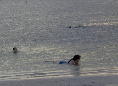
cooling off and looking for shells
I love taking pictures of the sunset


Well its forecasting to be hot and dry pulse storms popping up is never out of the questions if your in the I4 area but if your by the water like me we should see a repeat of today .
well I'm pretty tired now i hope i don't have to many typos..lol Good night and and have a Happy Monday!!
Wednesday, August 15, 2007
from the Sert homepage
Wednesday, August 15, 2007
Tropical Storm Dean Strengthens As It Continues Westward…Tropical Storm Erin Forms in Western Gulf…No Threat to Florida…Heat Advisory in Effect Again Today for Western Panhandle…Triple-Digit Heat Indices Continue Statewide…Scattered Afternoon Showers and Thunderstorms Expected…
At 11 AM EDT Wednesday, Tropical Storm Dean was located about 1050 miles east of the Lesser Antilles, or about 2400 miles southeast of the southern Florida coast. Movement is quickly toward the west at 20 mph. Maximum sustained winds have increased to near 60 mph, and Dean could become a hurricane by tomorrow as it moves further west into an area of weaker wind shear and increasingly warmer waters. An aircraft is scheduled to investigate Dean on Thursday afternoon. The current forecast from the National Hurricane Center keeps this system moving toward the west or west-northwest, bringing the storm across the Lesser Antilles by Friday as a Category 1 hurricane and into the eastern Caribbean Sea this weekend. Please note that there are significant uncertainties regarding long-range track and intensity forecasts for tropical cyclones. At the moment, this storm poses no threat to Florida, but it will be closely monitored.
In the western Gulf of Mexico, Tropical Depression 5 was upgraded this morning to Tropical Storm Erin. At 11 AM EDT Wednesday, Tropical Storm Erin was located about 250 miles east of Brownsville, Texas. Erin is a minimal tropical storm, with maximum sustained winds at around 40 mph. Movement is toward the west-northwest near 12 mph. A strong ridge of high pressure over the southern Plains will steer Erin toward the west, bringing the storm onto the south Texas coast sometime Thursday. This storm will have no impact upon Florida.
Meanwhile, high pressure will remain anchored over the southern Plains, keeping conditions sweltering across the state, particularly in the western panhandle, where dangerous heat and humidity is likely once again. A Heat Advisory is in effect through 7 PM CDT this evening for Escambia, Santa Rosa, and Okaloosa counties as heat indices there could climb as high as 113 degrees. Although slightly lower humidity levels and heat indices are expected over the remainder of Florida, it will still be hot, with temperatures in the mid to upper 90’s and heat indices of 100-108 degrees. Heat indices will reach the 100 degree mark before noon over many areas, falling below triple digits around 7 or 8 PM. Although no heat-related advisories are in effect for the remainder of the state, excessive heat safety should still be practiced.
If you must be outdoors, take precautions to avoid heat-related illnesses such as heat cramps, heat exhaustion, or heat stroke. Drink plenty of water, take frequent breaks, and check on the elderly as well as pets. Click here for more information and safety tips on excessive heat.
Isolated to widely scattered sea breeze-triggered showers and thunderstorms will be possible this afternoon, mainly over South Florida due to more low-level moisture. No widespread severe weather is expected, but any thunderstorms that happen to develop could become quite strong. Deadly cloud-to-ground lightning strikes, brief gusty winds, and locally heavy rain will be the main threats. Thunderstorm activity will subside after sunset.
Hurricane Local Statement forTropical Storm ERIN issued from Houston / Galveston, TX
Issued at 535 PM CDT WED AUG 15 2007
Atlantic Tropical Weather Outlook
000 ABNT20 KNHC 152102 TWOAT TROPICAL WEATHER OUTLOOK NWS TPC/NATIONAL HURRICANE CENTER MIAMI FL 530 PM EDT WED AUG 15 2007 FOR THE NORTH ATLANTIC...CARIBBEAN SEA AND THE GULF OF MEXICO... THE NATIONAL HURRICANE IS ISSUING ADVISORIES ON TROPICAL STORM ERIN...LOCATED ABOUT 195 MILES EAST OF BROWNSVILLE TEXAS...AND IS ISSUING ADVISORIES ON TROPICAL STORM DEAN...LOCATED ABOUT 910 MILES EAST OF THE LESSER ANTILLES. ELSEWHERE...TROPICAL CYCLONE FORMATION IS NOT EXPECTED DURING THE NEXT 48 HOURS. PUBLIC ADVISORIES ON TROPICAL STORM ERIN ARE ISSUED UNDER WMO HEADER WTNT35 AND UNDER AWIPS HEADER MIATCPAT5. FORECAST/ADVISORIES ARE ISSUED UNDER WMO HEADER WTNT25 AND UNDER AWIPS HEADER MIATCMAT5. $$ FORECASTER LANDSEA/BROWN
Monday, August 13, 2007
Introducing Noah!!!
Introducing Noah!!
My little harry boy is getting big,4wks now.

Weather has been quite boring lately. we had a nice little lightning storm last night,just north of us in hernando county recorded over four thousand lighting strikes.My sh%!ty camera didn't record not-ta.
We have a high to the east and a low in the southwest, so rain is not in the forecast in our west pasco area for at least a week. I am going through major withdraw I realy need a wopper of a storm to pull me out of this funk!!
Thursday, August 2, 2007
weather outlook

Atlantic Graphical Tropical Weather Outlook
--------------------------------------------------------------------------------
Note: This product is updated at approximately 11:30 AM and 10:30 PM EDT
Place your mouse cursor over areas of interest for more information
000
ABNT20 KNHC 020201
TWOAT
TROPICAL WEATHER OUTLOOK
NWS TPC/NATIONAL HURRICANE CENTER MIAMI FL
1030 PM EDT WED AUG 1 2007
FOR THE NORTH ATLANTIC...CARIBBEAN SEA AND THE GULF OF MEXICO...
1. SHOWERS AND SQUALLS ASSOCIATED WITH THE TROPICAL WAVE AND THE AREA
OF LOW PRESSURE ARE SPREADING OVER THE WINDWARD ISLANDS AND THE
EASTERN CARIBBEAN SEA. THERE ARE NO SIGNS OF TROPICAL CYCLONE
FORMATION AT THIS TIME BUT CONDITIONS APPEAR TO BE FAVORABLE FOR A
TROPICAL DEPRESSION TO FORM DURING THE NEXT DAY OR SO AS THE SYSTEM
MOVES WESTWARD. A RECONNAISSANCE PLANE WILL INVESTIGATE THE AREA
AGAIN ON THURSDAY...IF NECESSARY.
2. CLOUDINESS AND SHOWERS OVER THE NORTHEASTERN GULF OF MEXICO ARE
ASSOCIATED WITH A BROAD TROUGH OF LOW PRESSURE. THERE ARE NO SIGNS
OF ORGANIZATION BUT SOME SLOW DEVELOPMENT IS POSSIBLE DURING THE
NEXT DAY OR TWO.

yes its been wet for us her in pasco no storms just rain in the last two days we have received 3.5" (Thank you again dew for the rain gauge)
Its nice too see the lawn nice and wet but I would really like to see is that trough develop in too something wouldn't that be too cool!!!August is my favorite summer month with us being in the peak of the hurricane season it keeps us weather nuts busy!!
non weather news my kitty (still no name) is doing quite well getting bigger and now trying out his hind legs his little eyes opened last week and now they are wide open I'm not sure how well he sees yet but... He is so friggin cute!!

Subscribe to:
Posts (Atom)